

Conquering Nam Kang Ho Tao is far from what you think, challenging and promises an extremely exciting journey!
If this is the first time hearing the name Nam Kang Ho Tao, no wonder! You are just like most people who are hearing the name for the first time! Nam Kang Ho Tao is a mountain peak in Lai Chau and Lao Cai provinces, a wild mountain area with many slippery and steep cliffs. Many backpackers call this a “mortal road” with many complex terrains, without a helmet, you can hardly pass.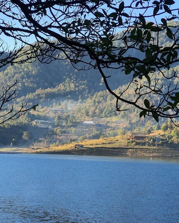 Scenery in Than Uyen Lai Chau @scentvn9x
But the charm of this Nam Kang Ho Tao trekking route makes many people passionate about conquering, once you step into the journey, you will have many unforgettable experiences, although a bit scary!
Where is Nam Kang Ho Tao?
This strange name sounds like it is in another country, not Vietnam, but it is a mountain located between the border of the two provinces of Lao Cai and Lai Chau and its location in Hoang Lien National Park. This mountain has an altitude of 2881m above sea level. You can choose 2 routes to conquer Nam Kang Ho Tao : if you have good physical strength, a lot of climbing experience and like to try difficult roads, you can choose to start in Lai Chau province and turn around. to Lao Cai province. But usually many people choose to depart from Lao Cai because it is easier.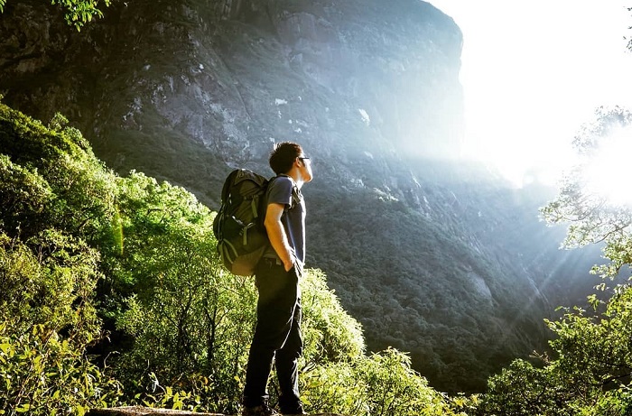 The way to conquer Nam Kang Ho Tao @thien_phong28
First you go to Sapa town then from here go to Ho Mit commune about 100km long. To Ho Mit commune, there is only one road to Thao A village, about 10km long, very bumpy and difficult to go with many stones and potholes.
The best time to conquer Nam Kang Ho Tao
The weather is not too hot or too cold is suitable for trekking on this same interesting road. February – March or September – November is the best time, dry weather and less fog will make it easier to navigate. Recommended trekking in spring or autumn @sherrytran124
Note that you should not go this route in the rainy season or after a long rain because it is very slippery, the water level on the stream forms a strong and dangerous current.
In addition, this is the road to conquer Nam Kang Ho Tao is not for first-timers because it is hard and not easy at all. You need to exercise and try other easier routes such as trekking in Lao Than .
Some notes when trekking Nam Kang Ho Tao
To have a complete Nam Kang Ho Tao hike , you need to book a tour and choose a porter as your guide to take you in the right direction on this road. In addition, you need to prepare all the necessary items for the climbing trip, need a light top and only bring what is really necessary.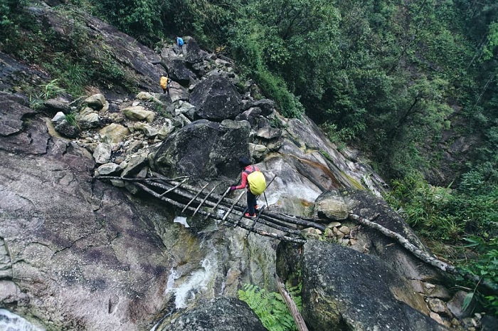 This is an arduous trekking route @tuanwalks
In addition to everyday items, do not forget to bring medicines such as fever reducer, abdominal pain reliever… or insect bite prevention drugs.
Learn carefully about basic skills such as how to move, camping, equipment to bring and some experiences of people because this is the most difficult trekking route in the Northwest . 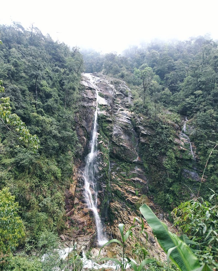 Crystal clear streams on the way to the top of Nam Kang Ho Tao @tuanwalks
Reference trekking schedule
You start from Sapa town in the morning after arriving at the bus station, prepare the most important items to bring enough for 3 days and 2 nights in the forest.
You will have to continue on to the shuttle bus to Than Uyen district, Lai Chau 100km from Sapa and start conquering Nam Kang Ho Tao. There will be an ethnic porter who knows the way to go with you.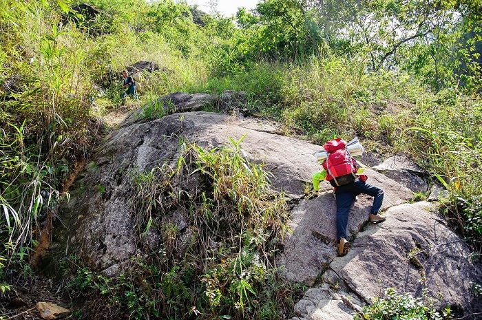 You have to be mentally prepared to climb over steep and large rocks
The first route is quite difficult because the terrain is steep and changes quickly along the way with large streams, steep cliffs that can only be overcome by swinging, very difficult and using all your strength with passable. The stream is clear and the scenery is dreamy of the mountains @anbinhbin
When you pass that difficult craggy rock wall, you will come to the cardamom forest with tall and wide trees. It’s time to stop ending conquering Nam Kang Ho Tao day 1.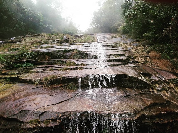 And you will have to cross rocks like this @sherrytran124
On the second day you will have to get up early to avoid the heat of the mountains and the next road is to pass streams, dense forests and bamboo forests. The fresh air of the mountains will make you feel more comfortable.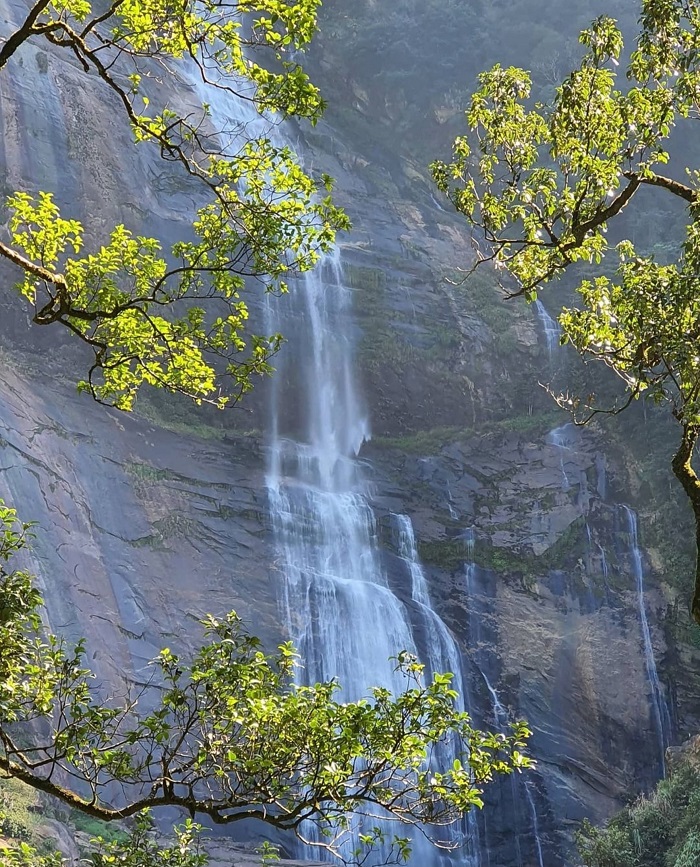 Beautiful and poetic waterfall on the way to the top @scentvn9x
After a long day you will arrive at the bamboo forest, which is home to dangerous snakes, and in the late afternoon to the saddle area, which divides Lao Cai and Lai Chau. From this area, the road is extremely dense and full of thorns, you will reach the top of Nam Kang Ho Tao mountain ! 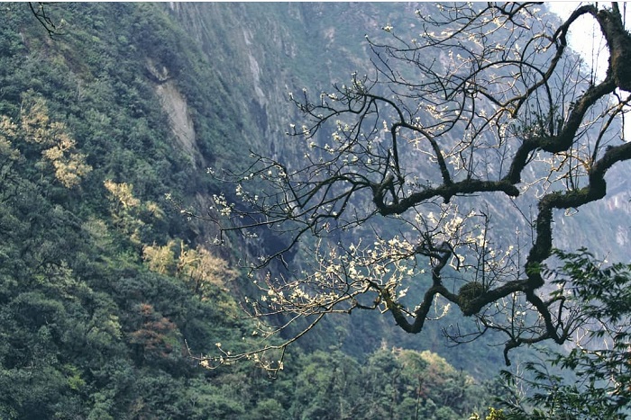 The beauty of the Northwest mountains @tuanwalks
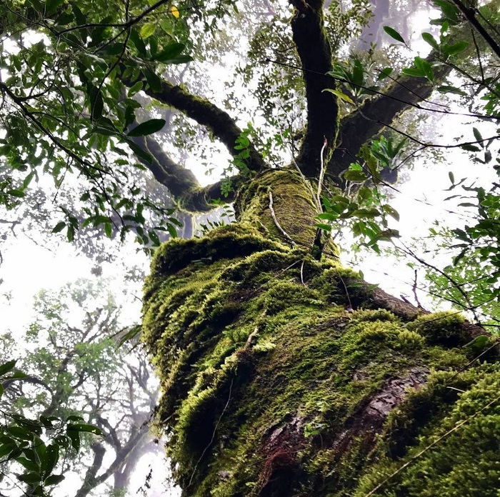 Big trees in the primeval forest @sherrytran124
After reaching the top, you will return to the camping area and spend the night here. The feeling of conquering Nam Kang Ho Tao will make you feel happy because you have overcome the challenge. The view on the top is nothing outstanding, just dry trees and weeds, but the distance is what stays in your mind.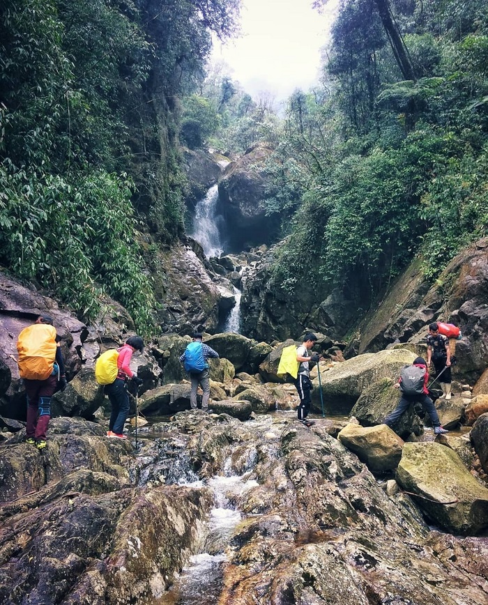 You will have to go through jagged paths like this @tuanwalks
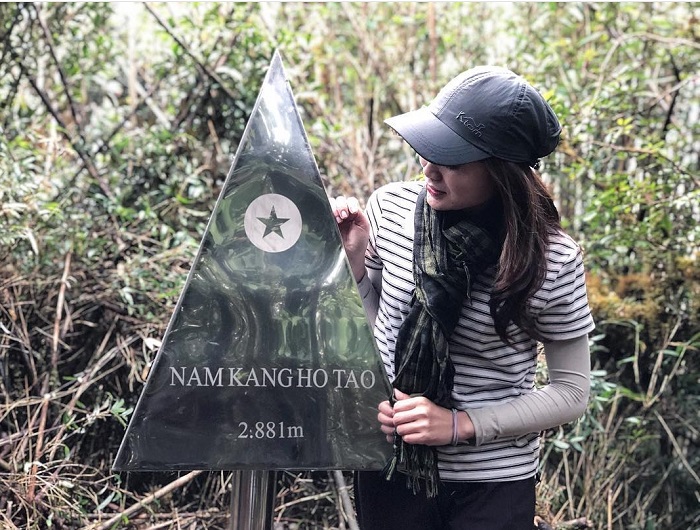 And the top of Nam Kang Ho Tao 2881 m will be your destination @hat.smile_
On the 3rd day of the Nam Kang Ho Tao itinerary , you will move down the mountain and return to Sapa in the same day, late in the evening you can return to town. Take a rest in Sapa and enjoy Sapa specialties to help you recover after 3 days of conquering the challenges of nature!
Photo: Internet