Truong Son Road’s eastern branch passes through the Central Highlands, once covered with thick jungle, now it has been destroyed, replaced by residential areas, towns… but the border areas of Tay Giang and Quang Nam are still wild in the midst of thousands of mountains and forests. contains many true mysteries.
Choosing Tay Giang – Quang Nam as the first stop on the journey from Truong Son East to Truong Son West branch was something I cherished for a long time before riding a motorbike alone to the mountains and forests of Quang Nam.
In the thousand-year-old “Po Mu kingdom”.
Traveling more than 130 km from Da Nang, at noon, we arrived at A Tieng commune, also the district capital of Tay Giang, with several rows of streets facing the district’s central square. Everything exudes a friendly, rustic and sad feeling. Have a temporary bowl of Quang noodles, then continue rolling along the pass west towards the border commune of A Xan. Occasionally, we meet groups of Co Tu ethnic women who, after a hard day going into the forest to cut bamboo, are sitting on the side of the road, splitting each segment into a short tube to leave tomorrow morning for traders or to bring directly to the market to sell to people. People make utensils to cook dishes: Lam rice, Zo Ra – famous dishes with bold flavors of the Truong Son mountains and forests that all Co Tu people can prepare.
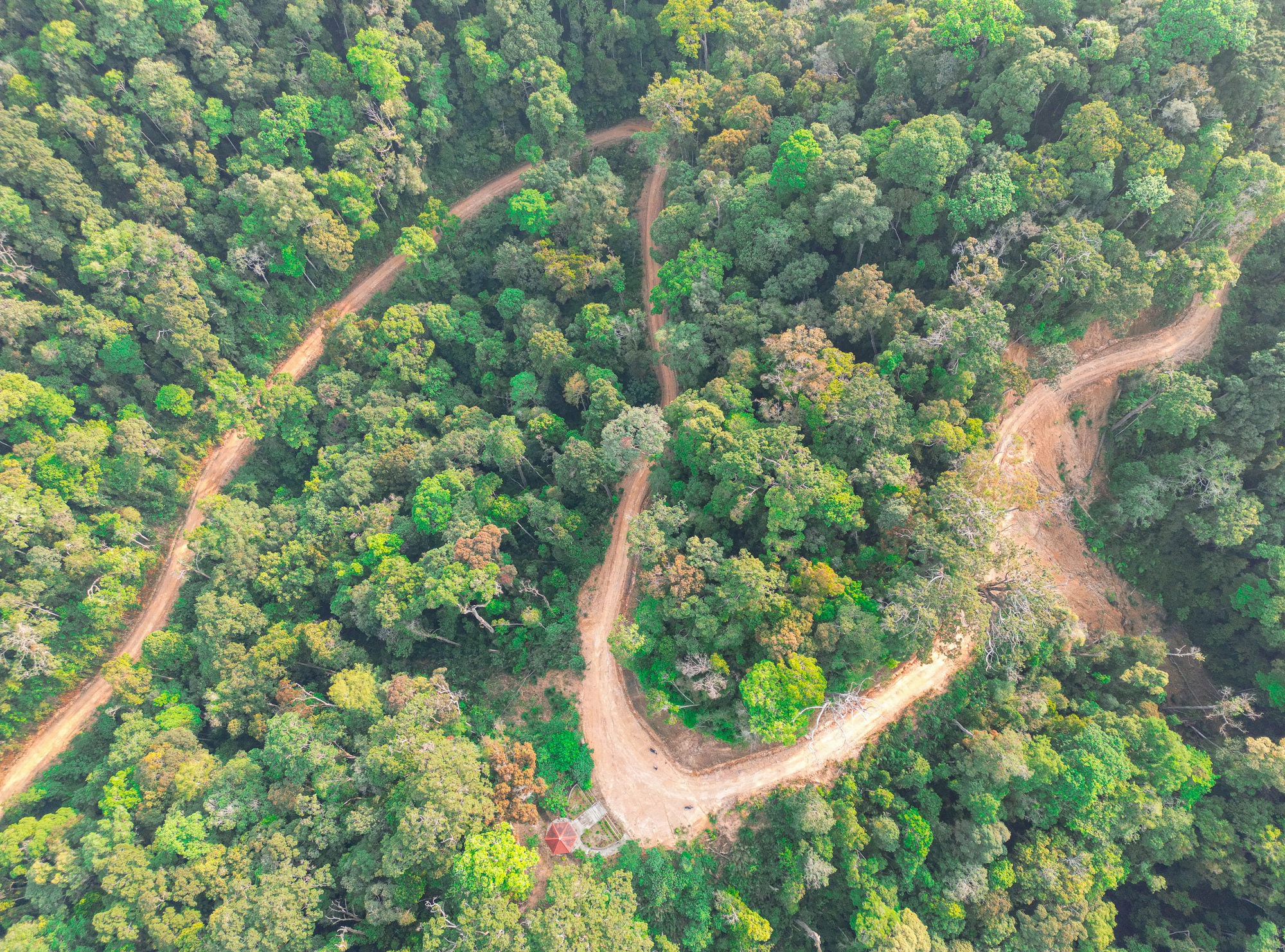
The road to the border is about 40 km long and gets higher and higher as evidenced by the peak of the Truong Son mountain range that many people have said. It also causes the car to constantly overheat and stall every time I drive through a long slope even though I have returns low number. And the drifting clouds sometimes swoop down into the deep valley, sometimes rise with the wind and spread across the mountain pass amidst the lush green of the dense forest on Que Peak at an altitude of 1,400m above sea level.
From the Bac Song Bung forest protection station at the back of the pass, I continued to drive with Mr. Moi – a Co Tu ethnic person across the 7 km long jagged green stone road to enter Po Mu forest.
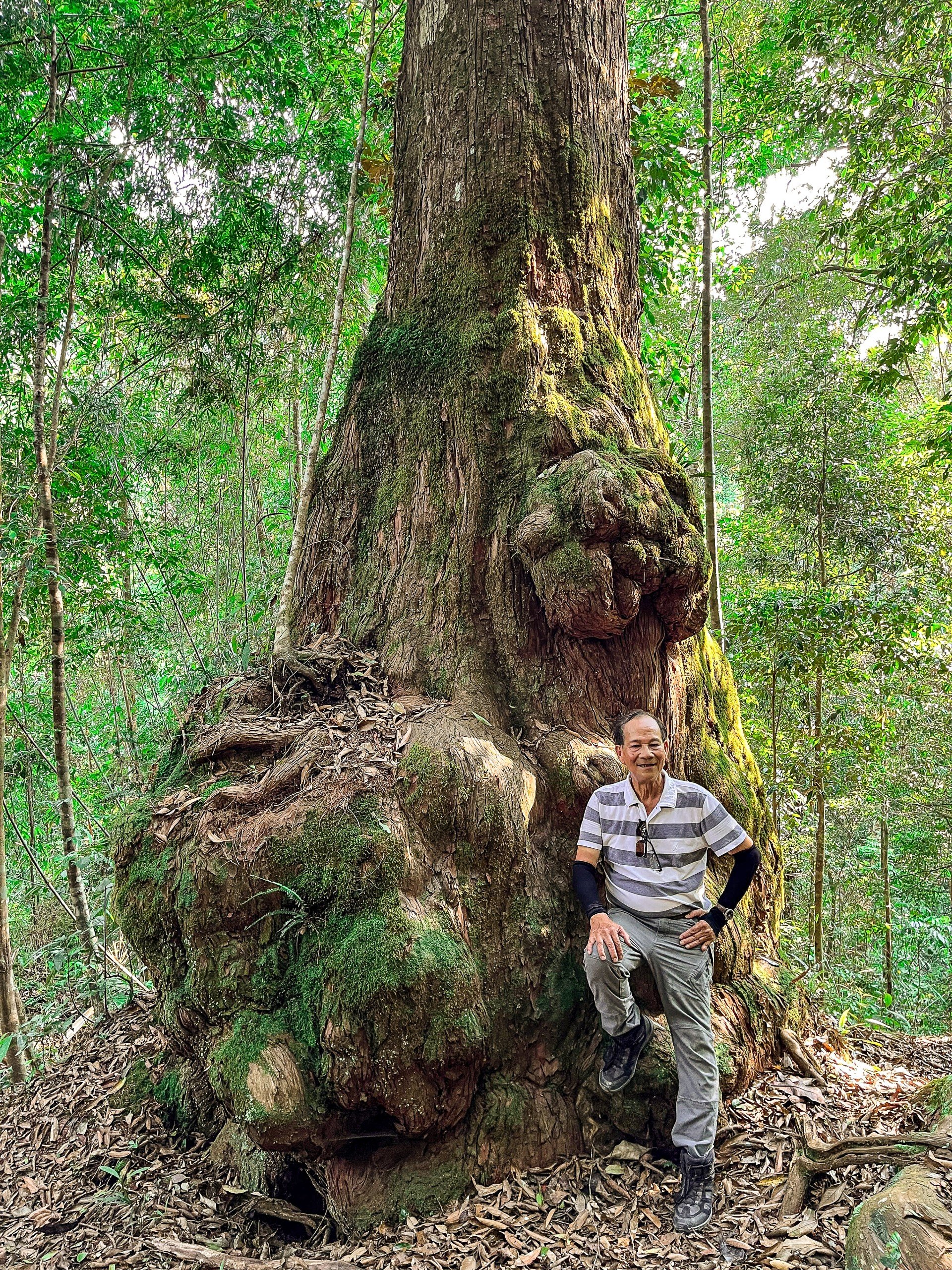
The first Po Mu “tree” we encountered was located on the back of the mountain with a tree trunk bearing many cracks, about 25m high and more than 2m in diameter, requiring 6 people to hug it. In particular, while the top with dozens of large, green branches swinging in the afternoon sun, the rough and dense roots are covered with moss, creating the shape of a sitting tiger, with a majestic appearance. Therefore, in addition to being numbered and located, “the old man” was also named Tiger tree by his relatives. Walk a few dozen steps and meet the “old man” named Dragon because his roots curl around the base of the tree and crawl on the carpet of old fallen leaves, creating a quite beautiful pose. It is true that “The dragon curls up and the tiger sits”.
The core area of the “Po Mu kingdom” is about 450 hectares wide, covering Zi’ien mountain at an altitude of 1,350m above sea level, discovered by Co Tu ethnic people in 2011. Of the 1,396 Po Mu trees that have been counted, , 725 trees with a diameter of 1.5m or more have been recognized as Heritage Trees by the Vietnam Association for the Protection of Nature and Environment. According to Mr. Briu Liec, Secretary of Tay Giang District Party Committee: In addition to the majority of Po Mu trees here that are 250 to 1,000 years old, a few are over a thousand years old, especially one individual located deep in the forest, considered the lord of the Po Mu kingdom because of its diameter of more than 4 meters and when drilling to take samples, it was determined to be 1,832 years old.
Although life today still has countless difficulties, the awareness of forest protection has been deeply ingrained in the Co Tu people’s subconscious, especially the watershed forests, forests with many giant trees… according to legend, they are the residence of the Co Tu people. The gods surround the people to survive and develop. That awareness has been expressed through customary laws and village regulations to protect the forest. Anyone who violates them will be severely punished by the village elders’ council. If they do it again, they will be kicked out of the village. In addition, performing rituals to thank Mother Forest at the beginning of the year, making offerings to open the forest to allow clearing for farming, or making offerings to ask for trees to be cut down to build houses for villagers or community houses are all strictly organized.
The beauty of Guol house
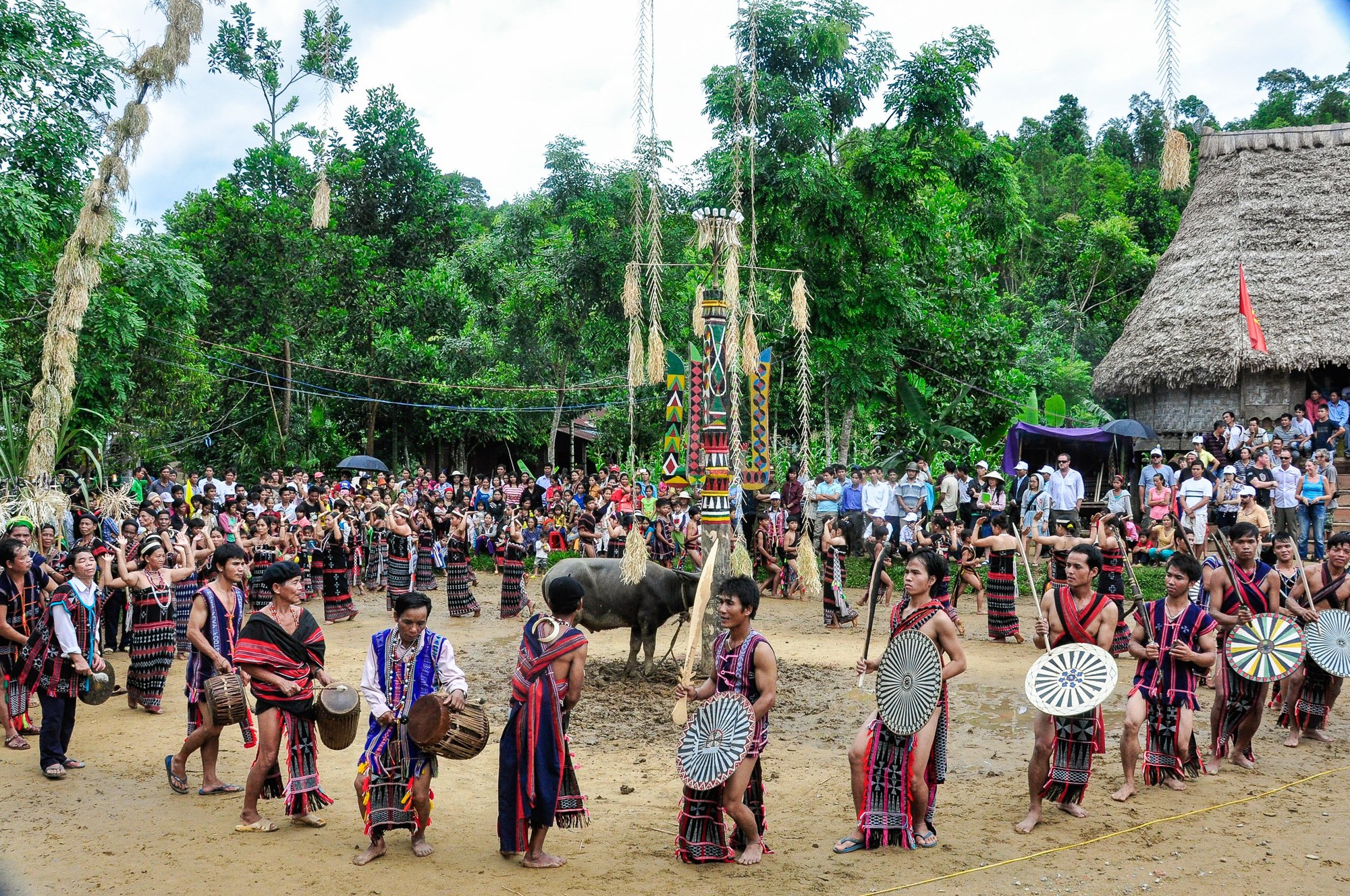
If the forest has a god, then the village has Giang, who in the past was worshiped by the Co Tu people at Guol – similar to the Vietnamese village communal house. Today, due to the demands of life, Guol has become a place for community activities for people in the village but is still associated with the buffalo sacrifice festival next to the ceremony pole (x’nur pole) erected in front of Guol – symbolizing Giang, the gods gathered to witness with the accompaniment of the bustling sounds of gongs, gongs, drums, and horns.
Furthermore, gongs and drums will create rhythm and melody for men wearing loincloths, holding swords, spears, and crossbow shields, walking around two trees in a counter-clockwise direction while recreating fighting and hunting movements. heroic appearance in the Tontung dance. Dancing at the same time, the movements shown in the women’s dadaq dance are somewhat flexible with their legs swinging around and their arms raised shoulder-high in a U-shape, simulating the image of carrying an offering to the sky.
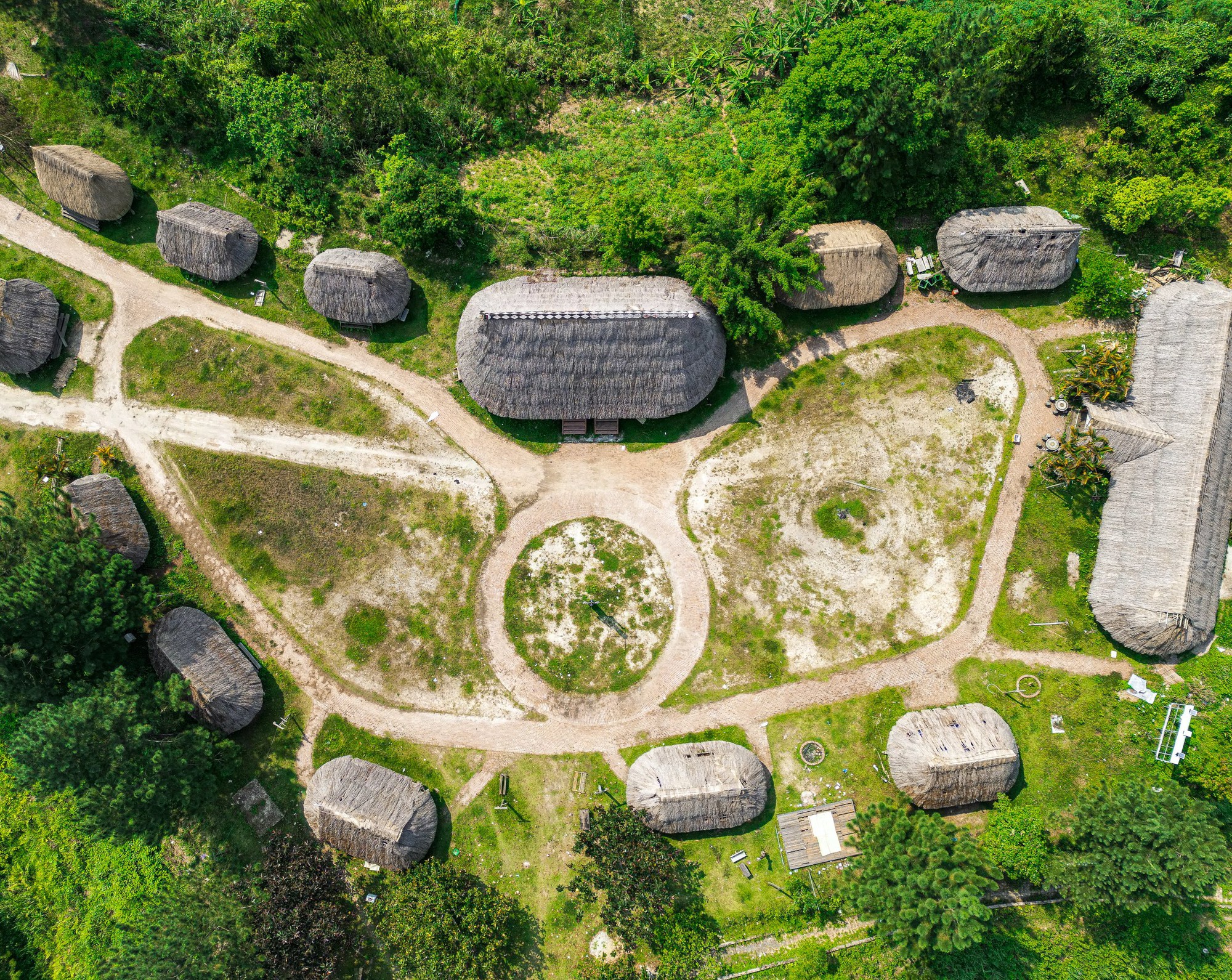
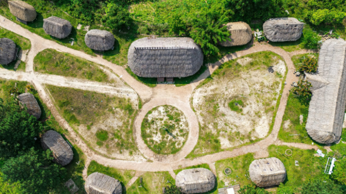
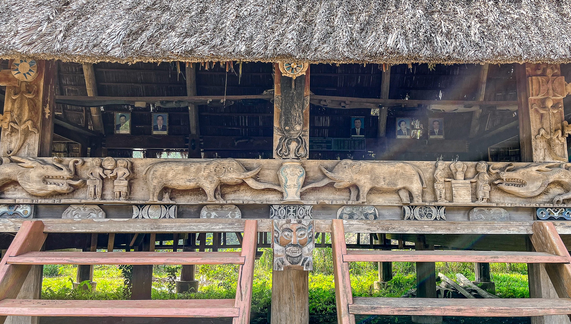
During my days traveling in Tay Giang, I set foot in the traditional cultural village, located on a hill overlooking the district center like a museum of outdoor house architecture. In addition to being massive and pristine, the model of the architectural complex includes 10 moong (traditional houses) representing 10 communes in the district, 1 long house, all arranged in an oval shape facing Guol – point As a highlight of the village, I can easily see that local artisans also beautify the interior of Guol with the skill of painting and carving on the pillars, pillars, and beams even though they only use rudimentary tools: knife for carving, ax for chiseling…; Colored stones and tree bark are used as decorative materials. The most unique are the whole planks used as partitions and railings around Guol. The artisans carved meticulously right on the surface of the planks to become a continuous relief depicting scenes of ancient hunting activities. .
In the beliefs of ethnic minorities living in the mountainous areas of Vietnam, most people, when conducting annual festivals, always erect a bamboo tree in the space of the long house or in front of the communal house yard if in the Central Highlands, Truong Son… In the Northwest and Northeast, people place them in the middle of the village or on terraced fields… even though the cultural nuances, spiritual meanings, names, and decorations are different.
However, with the Co Tu people, it is somewhat different, when the focus is on the ceremonial column built right in the middle of the Guol house’s front yard and divided into 3 floors symbolizing heaven, earth, and people: the top part of the column is the shape of the Guol house. of the god of rice, the middle of the column is carved with many rice mortars embracing the concave column in the middle, meaning prosperity, hoping for good harvests and the proliferation of species. At the base of the pillar, people reinforced a number of tree logs to make them more sturdy to tie up buffalo sacrifices or make an altar to arrange offerings of pigs, chickens, sticky rice, wine… Particularly, the two trees were originally built as two bamboo trees. On both sides, their tips and leaves sag and connect right at the top of the ceremonial column, symbolizing the connection between humans and the divine world.
Passing through “Minced Meat Hill”
Even though I stayed in Tay Giang for only 2 days and traveled everywhere, when I left the district capital to continue my journey to Lao Bao – Quang Tri, I still felt nostalgic as if I had to say goodbye to relatives at the old ferry station. . But we can’t dwell on the image of Guol’s house forever, the echoes of last night’s gong performance… because in front of us is a famous road with hidden dangers from steep slopes and curves.” elbow”, even mountain landslides are not uncommon… Therefore, any distractions and loss of concentration while driving can be incredibly dangerous.
Through the pass, heaven and earth opened up, and a few villages of the Ta Oi and Pa Co ethnic minorities appeared next to the far away green fields between two overlapping mountain ranges – a project facing the west is the border. Vietnam – Laos border…, one lies eastward, runs north and radiates many branches to the plain. From here, we begin to enter the highland border district of A Luoi – a place that when mentioned, people immediately remember that it used to be a military base area associated with fierce battles, typically the fighting that broke out. in May 1969 on the 937m peak of A Bia hill in A Sau valley near the Vietnam – Laos border. The American press at that time called A Bia “Minced meat hill” or “human meat grinder” to describe the level of brutality and high casualties under bombs and bullets.
From a desolate, barren and dioxin-poisoned land, now the highland border district of A Luoi has changed a lot compared to what I witnessed on my first trip 10 years ago. The streets are spacious and the residential area with red tile roofs growing closely under straight rows of green trees looks very imposing, not inferior to the lowlands. And in the district there are 2 national border gates, A Dot – Ta Vang, Hong Van – Cu Tai, connecting with Laos, creating favorable conditions for the two countries to trade, develop economically, culturally and socially. in the border area.
Unfortunately, A Bia Hill, although now ranked as a national monument by the Ministry of Culture, Sports and Tourism in 2021, is the fact that the number of tourists coming here is still modest. The main reason is that the investment in monuments is still quite monotonous, not reflecting the context of the brutal war that has passed. Therefore, to develop tourism and attract long-term visitors, the local tourism industry needs to invest and restore A Bia hill and A So airport as authentically as during wartime. In addition, building many tourism products, focusing on exploiting three main types available: visiting the forest ecosystem along the upstream of Dakrong, Bo, Huong rivers, learning the value of Ta ethnic identity. Oh, Pa Co and the nostalgia of the old battlefield…
Photo,Video: Internet
